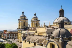
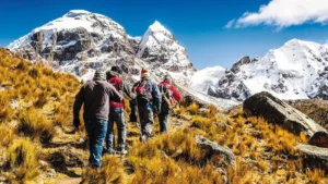
When most travelers think about the Andes, they picture iconic landmarks and postcard views. But beyond the famous routes lies a quieter, more authentic side of the mountains waiting to be explored. With the right perspective and a detailed Peruvian Andes map you can uncover destinations that remain untouched by mass tourism.
In this guide to 5 Hidden Gems on the Peruvian Andes Map, we’ll take you beyond the usual highlights and into remote valleys, lesser-known archaeological sites, and breathtaking landscapes that reveal the true spirit of the Andean highlands. If you’re looking to explore Peru in a deeper, more meaningful way, these hidden treasures deserve a spot on your itinerary.
Plan Unique Routes Beyond the Classic Circuits
Designing your journey with a Peruvian Andes map allows you to move beyond the traditional tourist flow and uncover regions that feel authentic, raw, and deeply connected to local culture. Instead of following a fixed route, you can trace mountain corridors, valleys, and lesser-known archaeological sites to create a more intentional and immersive experience. The Andes are not a single destination they are a vast network of landscapes waiting to be explored thoughtfully.
Discover Remote Landscapes and Hidden Archaeological Sites
One of the greatest advantages of using a Peruvian Andes map is identifying destinations that rarely appear on standard itineraries. Remote sites like Choquequirao offer monumental terraces and ceremonial spaces with only a handful of visitors each day, creating a far more intimate encounter than more crowded landmarks.
Beyond archaeological wonders, mapping out high-altitude lagoons, isolated valleys, and dramatic canyons allows you to experience the Andes as explorers once did navigating terrain shaped by glaciers, rivers, and centuries of Andean civilization. These routes reward travelers with silence, expansive views, and the rare feeling of discovery.
Connect with Living Andean Culture Through Alternative Treks
A strategic look at your Peruvian Andes map also reveals trekking routes that prioritize cultural connection over popularity. The Lares Trek, for example, winds through traditional villages where weaving, farming, and Quechua language remain central to everyday life.
Unlike more regulated trails, alternative treks allow flexibility you can include community visits, local markets, and natural hot springs along the way. These routes transform a simple hike into a cultural immersion, where landscapes and people are equally central to the journey.
By planning unique routes beyond the classic circuits, you turn your map into more than a navigation tool, it becomes a framework for deeper exploration, meaningful encounters, and a truly personalized Andean adventure.
You might also be interested in reading: 20 best beaches of Peru in 2026

Why you need a peruvian andes map to discover hidden gems?
The Peruvian Andes stretch for thousands of kilometers, encompassing cloud forests, snow-capped peaks, pre-Inca ruins, and villages where time seems to have stood still. A good map of the Peruvian Andes is not just a navigation tool, but the key to discovering ancient trails, new landscapes, and local experiences that rarely appear in popular itineraries or conventional travel guides.
With it, travelers can avoid crowds, follow traditional roads or trails, connect with indigenous communities, and immerse themselves in their culture, which has not been altered by mass tourism and modern development.
A Peruvian Andes map serves not only as a directional reference, but also as an educational resource, offering details about elevation, climate zones, and cultural landmarks that can shape your travel decisions. Unlike GPS, which can lose signal in remote highlands, a physical or topographic map allows for better planning and spontaneous exploration. With it, you can safely venture beyond typical routes, engage more meaningfully with local communities, and appreciate the profound connection between geography and tradition in the Andes.
Navigate Beyond the Tourist Hotspots
Most travelers concentrate on iconic destinations like Machu Picchu, but the Andes are far more expansive than a single landmark. A detailed peruvian andes map reveals secondary trekking routes, lesser-known archaeological complexes, and remote valleys that remain largely untouched.
By studying the terrain in advance, you can identify alternative access points, scenic detours, and communities that offer authentic experiences away from the crowds. This transforms your journey from a checklist of attractions into a deeper exploration of Peru’s living landscape.
Understand the Geography That Shapes Culture
The Andes are not only mountains they are ecosystems that directly influence how people live. A peruvian andes map highlights changes in altitude, climate zones, and natural barriers that have shaped trade routes, agricultural practices, and spiritual traditions for centuries.
From high-altitude plateaus near Lake Titicaca to cloud forest corridors in the north, geography explains why communities developed unique textiles, dialects, and ceremonies. When you understand the land, you understand the culture — and your journey becomes far more meaningful.
You might also be interested in reading: What to pack for Peru according to the season and destination
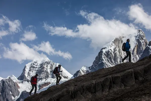
Exploring the Northern Andes: Kuelap and Gocta
When travelers unfold a Peruvian Andes map, most eyes go straight to Cusco and the Sacred Valley. But for those planning a broader journey whether traveling from mexico to peru or arriving from anywhere else in the world the northern Andes tell a different story: one of misty mountaintops, ancient civilizations, and landscapes that feel almost untouched by time.
High above the Utcubamba Valley rises Kuelap, a monumental stone fortress built by the Chachapoya civilization. Surrounded by cloud forest and dramatic cliffs, Kuelap offers an atmosphere that is both mysterious and powerful, far removed from the more frequented southern circuits.
Not far away, hidden within dense greenery, cascades Gocta Waterfall, one of the tallest waterfalls in the world. The hike to reach it winds through lush landscapes filled with biodiversity, offering a striking contrast to the high-altitude peaks often associated with the Andes.
Exploring this northern region reveals a quieter, more intimate side of Peru one where history, nature, and local traditions remain deeply interconnected.
Kuelap: The Fortress in the Clouds
High above the Utcubamba Valley stands Kuelap, a monumental stone citadel built by the Chachapoya civilization, known as the “Warriors of the Clouds.” Perched at over 3,000 meters above sea level, Kuelap predates Machu Picchu by several centuries yet it remains far less visited than the classic Machu Picchu tours that dominate most Peru itineraries.
Its massive limestone walls, some reaching 20 meters in height, enclose hundreds of circular stone structures. Mist drifts across the mountaintop, and the surrounding cloud forest creates a mystical atmosphere that feels worlds away from Peru’s more crowded southern attractions.
Using a detailed Peruvian Andes map, travelers can trace the route from the charming colonial town of Chachapoyas, reaching the site by road and cable car. Mapping this region reveals just how geographically diverse the Andes truly are — shifting from high-altitude plains to lush, tropical cloud forest within a short distance.
Gocta: A Giant Hidden in the Jungle
Not far from Kuelap lies one of South America’s most breathtaking natural wonders: Gocta Waterfall. With a dramatic drop of over 700 meters, it ranks among the tallest waterfalls in the world.
For generations, local communities knew of Gocta’s existence, but it remained largely unknown internationally until the early 2000s. Today, a Peruvian Andes map helps travelers locate the trailhead near the village of Cocachimba and plan the scenic hike through dense forest filled with hummingbirds, orchids, and occasional howler monkeys.
The journey itself is part of the magic. Eco-lodges tucked into the rainforest offer immersive stays, making this region perfect for travelers who want something beyond the classic Andes itinerary.
More Northern Treasures to Pin on Your Map
If you’re exploring this region, your Peruvian Andes map should also highlight:
- Revash – funerary structures carved directly into red rock cliffs.
- Leymebamba Museum – home to hundreds of remarkably preserved Chachapoya mummies.
- The quiet villages of Rodríguez de Mendoza and Lamud, where daily life still follows traditional Andean rhythms.
Northern Peru proves that the Andes are not a single destination — they are an entire world waiting to be explored.
Outhern Andes Secrets: Palcoyo and Ausangate
While many travelers mark Vinicunca on their itinerary, a closer look at a Peruvian Andes map reveals quieter alternatives just a few hours away. Palcoyo, for example, offers the same vibrant mineral stripes as Vinicunca but with far fewer visitors. Its shorter, more accessible hikes provide stunning panoramic views of the highlands, making it ideal for travelers seeking beauty without the crowds.
Further south, the majestic Ausangate rises as one of the most sacred peaks in the Andes. A Peruvian Andes map helps plan treks around its glacier-capped peaks, turquoise lagoons, and remote villages where ancient weaving traditions and Quechua culture continue. Exploring these areas offers not only breathtaking landscapes but also an authentic connection to the region’s living traditions, far from the usual tourist paths.
Palcoyo: The Peaceful Rainbow
Palcoyo offers the same vibrant mineral-striped mountains as Vinicunca — reds, ochres, and turquoise bands sweeping across the landscape but with far fewer visitors. The hike is shorter and less demanding, making it more accessible while still delivering panoramic views of the Andean highlands.
For travelers seeking beauty without crowds, Palcoyo is one of the smartest discoveries you can make using a Peruvian Andes map.
Trekking tours – Ausangate: The Sacred Glacier
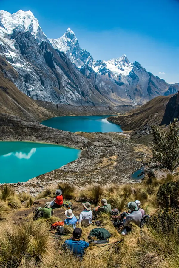
Beyond the rainbow mountains rises Ausangate, one of the most sacred peaks in the Andes. Towering above turquoise lagoons and roaming alpaca herds, Ausangate dominates the landscape of the Quispicanchis province and stands as a dream destination for high-altitude adventurers seeking authentic Trekking tours in Peru.
Trekkers who study a Peruvian Andes map can plan multi-day routes around the mountain, passing through remote communities where weaving traditions and the Quechua language remain central to daily life. These trekking tours offer not only dramatic scenery but also meaningful cultural encounters that few travelers experience.
Each year, thousands gather for Qoyllur Rit’i, a spiritual pilgrimage blending Catholic and Andean beliefs at the base of the glacier. The ceremony reflects the deep spiritual connection between Andean communities and the mountains they consider living beings.
What makes these southern destinations truly extraordinary is their isolation. Without a well-planned Peruvian Andes map, reaching them can be challenging — but that very remoteness preserves their authenticity. Trails remain largely unchanged, traditions continue uninterrupted, and the Andes reveal themselves not as a tourist attraction, but as a living cultural landscape best explored through carefully designed Trekking tours.
You might also be interested in reading: Authentic Peruvian Food: Discovering Peru One Flavor at a Time
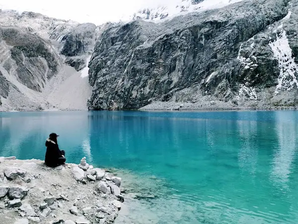
Mapping Andean Culture and Living Traditions
Peru’s geography is deeply tied to its cultural rhythms. A reliable Andes map can also guide you to festivals, ancestral routes, and remote communities where Quechua is still spoken and ancient weaving techniques are alive.
Whether it’s the Inti Raymi celebrations in a highland town or a traditional market deep in the Apurímac region, your map connects you not just with places, but with the people and their stories.
Beyond landmarks, maps point to celebrations. You might discover local festivities like:
– Inti Raymi, the Festival of the Sun, held in both Cusco and smaller towns
– Carnavales Andinos, celebrated with dance, music, and water fights
– Qhapaq Raymi, the warrior festival held in December
Each of these events is deeply connected to the land, the agricultural calendar, and tradition. A map will help you plan your visit so you can witness these traditions firsthand.
Design Your Authentic Journey Using a Peruvian Andes Map
Forget rigid tours and generic itineraries. A Peruvian Andes map gives you the freedom to design your own path through one of the most geographically and culturally diverse regions on Earth. Whether you’re an avid hiker chasing high-altitude challenges or a cultural traveler seeking meaningful encounters, the Andes open the door to truly magic experiences peru travelers often miss when following standard routes.
Instead of moving from highlight to highlight, a well-planned route allows you to connect landscapes, history, and living traditions into one cohesive journey. The beauty of using a detailed Peruvian Andes map is that it reveals how interconnected these destinations really are valleys flowing into canyons, remote ruins hidden beyond snow-capped peaks, and villages where ancient customs continue uninterrupted.
Here are just a few extraordinary routes you can build into your personalized adventure:
Apurímac Canyon: Raw Nature at Its Finest
The dramatic Apurímac Canyon is one of the deepest canyons in the world, carving a powerful path through the southern Andes. Less visited than Peru’s more famous trekking circuits, this region is ideal for rafting, multi-day hikes, and immersive nature excursions.
Mapping this area carefully allows you to combine remote trails with authentic rural communities, creating a journey that feels wild, vast, and deeply personal.
Choquequirao: The Sister City in Silence
Hidden high in the mountains lies Choquequirao, often called the “sister city” of Machu Picchu. Unlike its world-famous counterpart, Choquequirao receives fewer than 20 visitors per day.
Reaching it requires effort a demanding trek through steep valleys but that challenge is precisely what preserves its magic. When you stand among its terraces and ceremonial platforms, often completely alone, you experience the Andes in their purest form. A Peruvian Andes map helps you visualize the route and connect Choquequirao with surrounding trekking circuits for a more expansive expedition.
The Lares Trek: Culture Over Crowds
For travelers seeking an alternative to the classic Inca Trail, the Lares Trek offers a powerful combination of scenery and culture. This route winds through high-altitude villages, glacial lagoons, and natural hot springs, giving you insight into daily Andean life.
Unlike more regulated routes, Lares allows flexibility. With a strategic look at your Peruvian Andes map, you can adapt the trek to include cultural homestays, weaving communities, or scenic detours that transform your itinerary into something truly distinctive.
Create Your Own Story in the Andes
Designing your journey this way turns travel into something more intentional. A Peruvian Andes map becomes more than a navigation tool — it becomes a blueprint for discovery.
From dramatic canyons to sacred ruins and living mountain cultures, the Andes reward travelers who look beyond the obvious. When you move past the standard circuits and craft your own route, Peru stops being a checklist of attractions and becomes a landscape of magic experiences peru is quietly waiting to offer.
You might also be interested in reading: Cusco Nightlife: Best Bars, Restaurants, and Clubs
Ready to discover your own hidden gem?
The Peruvian Andes map is not only useful for finding your way around, but also for uncovering unexpected treasures. Whether you’re exploring ancient fortresses, remote villages, or colorful festivals, a good map helps you experience the true richness of Peru. It allows you to see the country not as a checklist of tourist spots, but as a living, breathing landscape full of stories, traditions, and breathtaking scenery.
With a map in hand, you can venture off the beaten path to discover hidden trails, secret viewpoints, and local communities that rarely welcome outsiders. You can plan hikes through cloud forests, follow winding rivers to secluded lagoons, or navigate high-altitude passes where the Andes feel endless. Every route becomes an opportunity for discovery, and every stop a chance to connect with Peru’s vibrant culture.
Ready to explore Peru your way? Check out our selected adventures, designed for travelers looking for more than the usual. With the right Peruvian Andes map, Peru opens up like a treasure chest, and the hidden gems you find along the way will stay with you for a lifetime.